active filter: risk

Card image cap

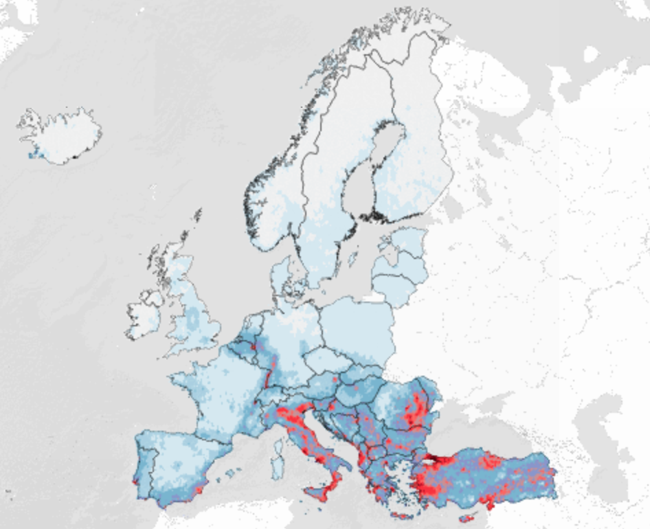
European Seismic Embodied Carbon Viewer

This map illustrates the geographical distribution of the total replacement embodied carbon of buildings (residential, commercial, industrial) within the GEM's European Exposure model v2023.1. The Average Annual Embodied Carbon (AAEC) is also shown as a m…

risk exposure

Updated by mcaruso
on Jan 27, 2025
Card image cap

European Seismic Risk Index Viewer

This map presents a seismic risk index that has been calculated using the European Seismic Risk Model (ESRM20).

risk

Updated by hcrowley
on Apr 28, 2022
Card image cap

European Seismic Risk Model Viewer - Country Level Data

This map presents a number of different country-level risk metrics of the European Seismic Risk Model (ESRM20).

risk

Updated by hcrowley
on Dec 14, 2021
Card image cap

European Seismic Risk Model Viewer - Admin 1 Level Data

This map presents a number of different first administrive level (admin1) risk metrics of the European Seismic Risk Model (ESRM20).

risk

Updated by hcrowley
on Dec 14, 2021